-
")
Gandlauenengrat (2079m)
-
-
")
| xxMap |
Gandlauenengrat (2079m) |
Mapxx |
-
-

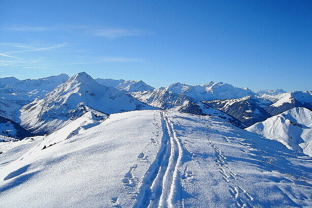
Ski traces
-
-
")
Giferspitz (2542m)
-
, Horntube (1994m)")
Hornfluh (1949m), Horntube (1994m)
-
")
Rüwlishorn (2228m)
-
")
Wistätthorn (2362m)
-
-

| xxMap |
The ridge to the summitt |
Mapxx |
-

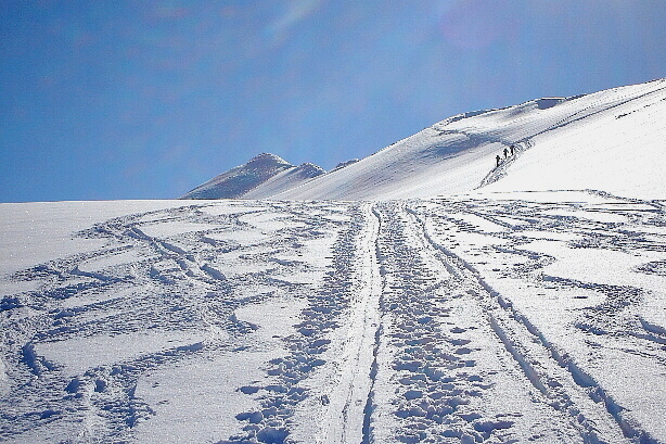
The ridge to the summit
-
, Lauenenhorn (2477m) and Giferspitz (2542m)")
Sommet des Diablerets (3210m), Lauenenhorn (2477m) and Giferspitz (2542m)
-

Vanil Carré, Pointe de Paray, Vanil Noir, Dent de Folliéran, Dent de Brenleire
-

Pointe de Paray, Vanil Noir, Dent de Folliéran, Dent de Brenleire, Wandfluh
-

Wandfluh, Gastlosen, Hundsrügg, Schwyberg, Horntube
-

Look to the north
-
, Diemtigtaler Rothorn (2410m), Rauflihorn (2322m)")
Spillgerte (2476m), Diemtigtaler Rothorn (2410m), Rauflihorn (2322m)
-
, Albristhorn (2762m)")
Männlifluh (2652m), Albristhorn (2762m)
-

Eiger, Mönch, Jungfrau, Lohner, Laveygrat
-

Balmhorn, Altels, Rinderhorn, Steghorn, Bütschifluh
-
")
Wildstrubel (3244m)
-
, Rohrbachstein (2950m)")
Les Faverges (2968m), Rohrbachstein (2950m)
-
, Iffighorn (2378m), Schnidehorn (2937m)")
Rohrbachstein (2950m), Iffighorn (2378m), Schnidehorn (2937m)
-
, Sommet des Diablerets (3210m)")
Spitzhorn (2807m), Sommet des Diablerets (3210m)
-

Look down